Tughlaqabad Biodiversity Park
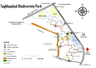
Location and Landscape Features The District Park at Tughlaqabad Tehkhand Phase II located in the southern ridge spreads over an area of 200 acre and includes the eastern gentle slope of the Tughlaqabad Fort area. The terrain is undulating with ridges and depressions; most of the ridges are flat, and are either barren or with scattered bushes of Prosopis juliflora. A number of shallow depressions are present across the landscape and these are recharging zones of rainwater. There are four major waterbodies (wetlands) that receive surface drainage from the Fort area. These waterbodies are filled with untreated sewage discharged from the encroachments inside the Tughlaqabad Fort area. The storm drains (surface drainage channels) have been converted into sewers, and sewage flows into waterbodies by gradient.
Major functions of Tughlaqabad Biodiversity Park Tughlaqabad Biodiversity Park harbours and preserves natural heritage of the area including flora and fauna, besides providing a wide range of ecological services and goods such as: (i) recharging of ground water, (ii) buffering local weather, (iii) serving as sink for CO2 and other pollutants, (iv) conserving natural heritage of the area, (v) promoting environmental awareness among the public and students, (vi) serving as a living laboratory and hub for environmental education among school, college and university students, and (vii) providing recreational value to the public. Coupled with its ecological diversity and restored waterbodies, it will be an important birding area, besides forming a habitat for bigger mammals.
Restoration of Tughlaqabad Biodiversity parks has been initiated which includes:
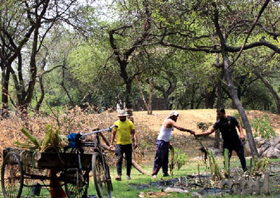
- Development of Infrastructure To prevent cattle grazing and illegal dumping of solid waste inside the Biodiversity Park, construction/ strengthening of boundary wall is being initiated. Nature trails are also being laid. To facilitate the movement of Visitors, wicket Gates are being constructed.
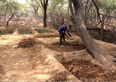
- Site Preparation and De-weeding For the upcoming plantations in Monsoon pits of 1*1 feet size have been dug out and enriched with farmyard manure. To keep check on the exotic and invasive weeds such as Argemone sp., Hyptis suvaveolens, Parthenium, they are constantly being uprooted at large scale. Lantana camara and new saplings of Prosopis juliflora, are being eradicated by using Cut Root-Stock Method.
Canopies of Prosopis juliflora is being opened to allow sunlight to reach new planted saplings and the chopped canopies are used as fencing material to protect saplings from herbivores. - Development of Biological Communities Based on the topography, altitudinal variation and depth of the valleys, various forest and wetland communities will be developed. It is proposed to develop 30 biological communities characteristic of Aravalli mountain ranges. Out of these 30 biological communities, 30,000 saplings of 6 biological communities have already been planted.
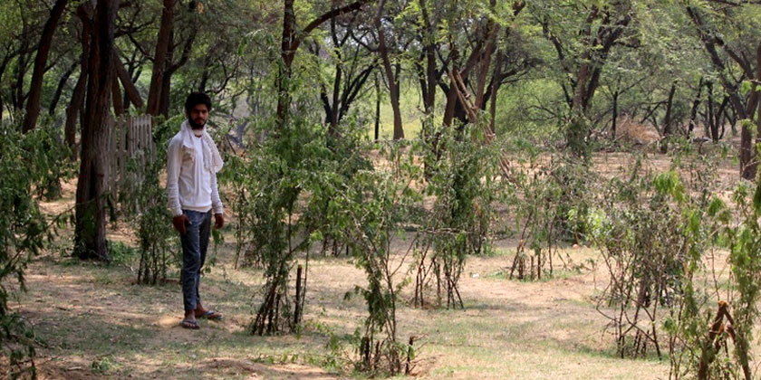
- Fencing strategies for Protection of Sapling More than 70% of the tree saplings are surviving and are showing new sprout/leaf initiation. Three layered fencing to protect plants from Cattle, Monkeys and Nilgai. includes thick branches of Prosopis juliflora, twigs of Capparis sepiaria and Un-pruned branches of Prosopis juliflora
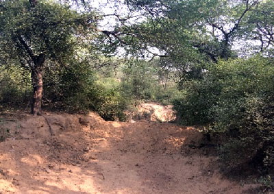
- Gully Plugging and Water Conservation A GIS Map has been created of the Watershed of Tughlaqabad Biodiversity Park using GPS monitoring slopes, gullies and potential water conservation zones.
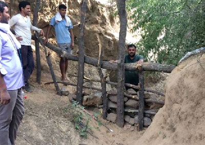
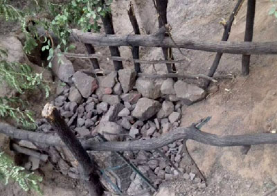
A series of loose boulder check dams across gullies in Tughlaqabad Biodiversity Park is made using loose boulders and Logs of Prosopis juliflora. These check dams will be constructed at every 50-100m distance in Narrower Gullies covering an area of 1 km in Office’s side and over 3km in Khaar area. The water impounded will be used to enhance ground water and reduce the run off in Kalkaji Drain. In addition to that in consecutive years it will enrich the soil moisture and reduce the soil erosion. - Establishment of nursery and compost pit: To raise saplings of native trees and to multiply grass species, a nursery has been developed. It has a stock of 15,000 saplings. A net house and poly house are being planned to construct.
- Recreational Park A Recreational Park is being developed. Massive plantation of plants of desired communities is done each year in the monsoon season.
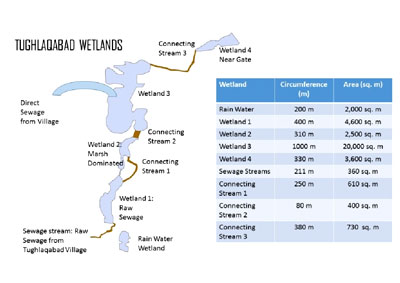
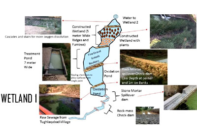
- Restoration of 4 waterbodies and development of constructed wetland system to treat raw sewage The action Plan for restoration of 4 waterbodies and construction of wetland system is being implemented. The details of wetlands and their interconnecting channels and the area occupied by them and the proposed constructed wetland system are given below:
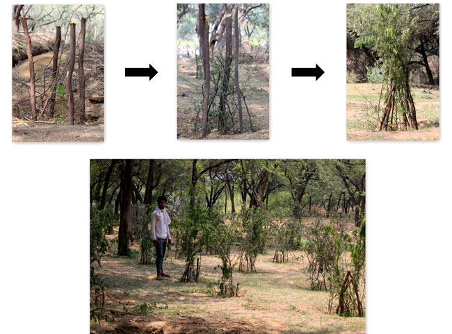 |
Three Layered Fencing to protect from herbivores |
 |
 |
|
| Map 1: Gully Map of Tughlaqabad | ||
|
||
 |
 |
|
Loose stone check dams on each 50-100 m in the Gullies |
||
 |
 |
|
|
||
 |
||
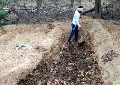
Compost pits are created for mulching and manuring purposes |
||
 |
 |
|
|
||